Hudson River Flooding Decision Support System, Version 1
The Hudson River Flooding Decision Support System mapping tool was designed to help inform municipal planning decisions.
Please note:
- Flood events mapped with blue shading indicate the tidal Hudson River floodplain only
- Both storm surge and tributary freshwater inputs to the Hudson River are included
- Tributary floodplains are not included in the modeling and mapping
About the Mapping Tool
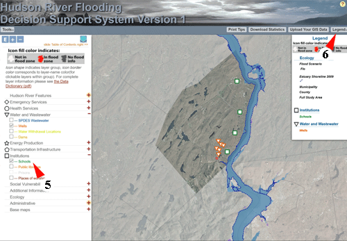
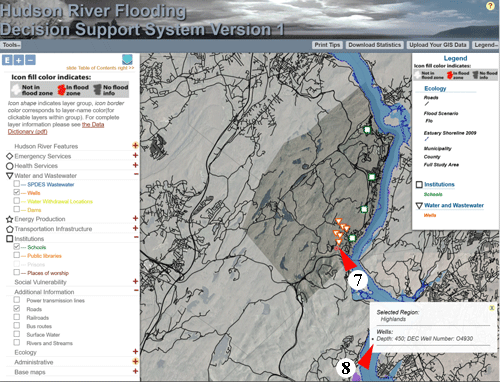
The data, maps, and information in this Mapping Tool are provided to illustrate the scale of potential flooding in the Hudson River Valley under multiple sea level rise and storm scenarios, merging the effects of storm surge and rainfall. The tool also provides downloadable estimates of flooding impacts, including affected population and critical infrastructure and cost estimates of building damage.
How to use the Mapping Tool
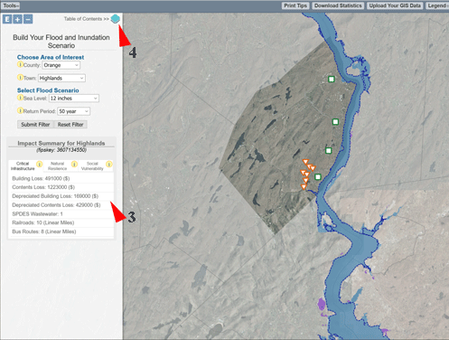
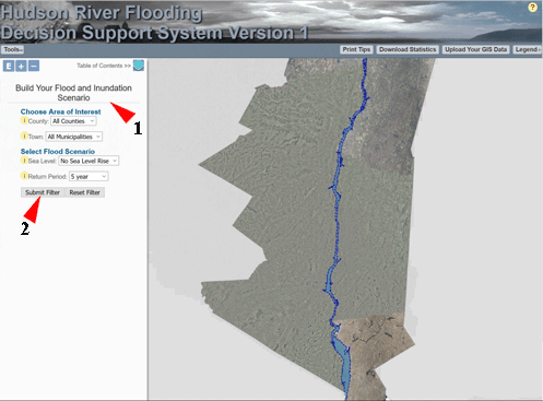
2) Click 'Submit Filter'
Disclaimer
The Hudson River Flooding Decision Support System mapping tool is meant to inform municipal planning decisions. It is not intended for storm preparations, navigation, permitting, or legal purposes. The data and maps in this tool are provided "as is." The mapping tool does not warrant or guarantee the accuracy or completeness of the content on this website. Furthermore, such data and information may change without notice. By use of this Web site, the entire risk associated with use and results of these data and maps is assumed by the user. Under no circumstances, including but not limited to negligence, shall the creators of this mapping tool be liable for any direct, indirect, incidental, special, or consequential damages.
Printing
We have added print styles to facilitate printing the map using your browser's print capability, but you may find these tips useful:
- Depending on the area you are viewing, selecting "landscape" print mode may result in a larger and more useful map image.
- If the map appears distorted in the print preview (or actual print), resizing the whole browser window to the approximate height/width ratio of your sheet of print paper before selecting "print" or "print preview" may help to produce a less distorted map image.
- Any Internet Explorer compatibility settings you may have altered could interfere with map printing; the browser should be set to use "Edge" rendering mode for best performance.
View the Data Dictionary (pdf)
The 'help' area is still being developed; we hope your comments and questions will aid us in populating the pages with more complete and helpful information on the use of this Mapping Tool and its data.