The Hudson River Flood Impact Decision Support System is an interactive map application that allows users to evaluate the scale of potential flooding for tidally-affected shorelines of the Hudson River Valley and Westchester County under a variety of sea level rise and storm scenarios detailed here.
The data, maps, and information in the Hudson River Flood Impact Decision Support System are provided to help inform, analyze, and visualize flood risk. Precise estimates of future flood risks remain uncertain given a range of possible sea level rise and storm scenarios, but with adequate preparation and education, individuals, communities, and municipalities can take action to make themselves more resilient.
The Hudson River Flood Impact Decision Support System is a tool that can offer impacted populations the information they need to better prepare for an uncertain future.
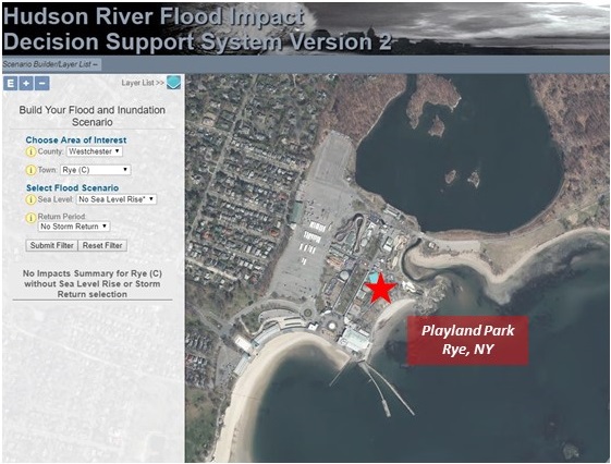
The snapshot from the mapper highlights Playland Park in Rye, NY with a typical Hudson River extent.
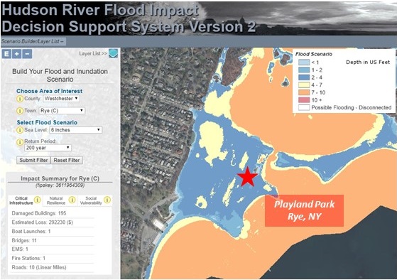
For comparison, Playland Park under the 6 inches of sea level rise, 200 year storm return flood scenario